An Economic History
of Garfield County
Named for the 20th President of the United States,
James A. Garfield
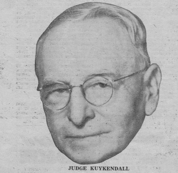
By Judge Elgin Victor Kuykendall
Native Americans were the first known inhabitants of what is now Garfield County. The indigenous people of this region were the Nez Perce--their name derived from the French term for "pierced noses." Though indigenous to the region, the Nez Perce lived a semi-nomadic life--one that included seasonal treks across the Rocky Mountains to the Great Plains where they would hunt buffalo. From this custom was established the Nez Perce Trail.
The Nez Perce Trail extended eastward from the Columbia River at the present-day town of Wallula (in Walla Walla County), through present-day Garfield County, and across the Rockies to the Great Plains. Tribes from across what is now the western United States gathered on the plains to participate in the traditional buffalo hunt before returning home. Other south-central Washington tribes frequenting the trail were the Yakima, Klickitat, Walla Walla, Cayuse, and Umatilla.
The trail, however, was more than a road to the buffalo hunting grounds. It was the principal travel route across the Rockies. As such, it was also used by tribes on both sides of the range to maintain social contacts and to engage in commerce. In fact, it is believed to have been the most widely used route in the entire western territory. It should be further noted that the Nez Perce also employed canoes, traveling upon the Snake River and other tributaries.
"A lasting testament to the strategic placement of the Nez Perce Trail and its importance to the development of the region was its use by white explorers Lewis and Clark and B.L.E. Bonneville, as well as by fur trappers, prospectors, the military, missionaries, and homesteaders. Even today, highways more or less parallel the ancient trail.
The Lewis and Clark Expedition signaled the beginning of white exploration in what would become Garfield County. In 1805, the party passed the county along its northern Snake River border on their westward journey to the Pacific Ocean. On their return trip in 1806, the party left the Columbia near the present-day town of Wallula and cut an eastward path through the heart of Garfield County on horseback. They used the old Nez Perce trail as their guide (which roughly parallels present-day Highway 12). The observations of Garfield County made by Lewis and Clark in their travel dairies were quite favorable and stimulated great interest in the new territory.
The fur industry was among those most interested in the region. From its Fort Walla Walla trading post (erected near present-day Wallula in 1818), the British Northwest Fur Company expanded its operations into Garfield County. In 1821, the Northwesters were taken over by the Hudson's Bay Company--thus giving the latter a virtual monopoly over fur trade in the new territory. Garfield County (indeed much of southeast Washington) proved a profitable region within which to trap. Beaver and otter were especially abundant in and around the Tucannon River in the county's panhandle. In 1833, Captain B.L.E. Bonneville reconnoitered the region on behalf of American fur interests. His journey was immortalized in Washington Irving's, The Adventures of Captain Bonneville.
Among the notable migration parties was that led by John Work, an agent of the Hudson's Bay Company. Starting from the Fort Walla Walla outpost in September of 1831, Work and his 56-person party followed the Nez Perce Trail as they headed east across Garfield County and other parts of southeast Washington to the Upper Snake River country. Other settlement parties were led by missionaries-- most notably Dr. Marcus Whitman and Reverend Henry H. Spalding in 1836. Spalding's impact on Garfield County history was the more pronounced of the two because of his relative success in converting many of the local Nez Perce Indians to Christianity.
When Washington Territory was established in 1853, present-day Garfield County was part of Walla Walla County--a county that encompassed all of eastern Washington, Idaho, and one-fourth of Montana.
A Nez Perce Indian named Daniel Types is believed to be the first permanent settler in Garfield County. Types, an early convert of Reverend Spalding, cultivated corn and other vegetables on half an acre of land in the Alpowa Valley. The first white settler in Garfield County was a man by the name of Parson Quinn who settled in the Pataha Valley about 11 miles from present-day Pomeroy. He was followed by the likes of J. M. Pomeroy who arrived in 1864 to later own and operate a renowned eatery and stage station at the future site of the town of Pomeroy. (This eatery and stage station was located at the current site of the Hotel Revere Building.)
The establishment of a stagecoach line between the towns of Walla Walla and Lewiston in 1862 precipitated a wave of migration into the Pataha and Alpowa Valleys. Most of the new arrivals engaged in either cattle ranching or vegetable farming. Wheat farming, from which the area eventually gained its reputation, was not yet recognized as a feasible undertaking.
By 1875, the region's population had grown to the point that the Columbia-Garfield-Asotin area was partitioned from Walla Walla County to form Columbia County.
In 1877, Columbia Center became the first town platted in what would become Garfield County. It was situated in the foothills of the Blue Mountains along Pataha Creek at the northern end of the county panhandle. At that time, it was in Columbia County, hence the town name. Though no more (it faded in the late 1880s after being bypassed by the Union Pacific line that ran between Starbuck and Pomeroy), it is remembered as a bustling town which, at its height, had sawmills and flour mills, a post office, stores and shops, saloons, restaurants, stables, blacksmiths, a school, and a host of private residences.
The town of Pomeroy was platted in 1878 after Joseph M. Pomeroy and William C. Potter built a flour mill on the site. The town expanded quickly as newcomers fueled the demand for a center of service and trade. By 1880, Pomeroy surpassed Columbia Center and others as the leading town in the region. It did, however, receive stiff competition from the nearby town of Pataha (3 miles east of Pomeroy).
In 1881, population growth compelled the territorial legislature and Territorial Governor W.A. Newell to partition the southeast Washington region once again, thus creating Garfield County. It was named in memory of the late President James A. Garfield who was assassinated earlier that year. The new county encompassed what we now know as Garfield and Asotin counties (the boundaries of present-day Garfield County were established in 1883 when it was partitioned to create Asotin County). The economic rivalry between Pomeroy and Pataha boiled over into a political rivalry as the two fought fiercely for the right to be the county seat. Though Pataha held the privilege temporarily, Pomeroy ultimately prevailed.
The creation of Garfield County precipitated yet another wave of immigration and settlement into the county, particularly into the Pomeroy area. Consequently, Pomeroy was incorporated on January 27, 1886. Cityhood was matched by an equally important event but a few days earlier -- the completion of the Starbuck-Pomeroy line by the Oregon Railroad & Navigation Company (O.R.N.C.).
The economic development of Garfield County cannot be adequately described without mentioning the forms of transportation that supported it. Before the arrival of the railroad, freight was shipped to Garfield County via a network of steamers and wagons. Freight usually originated in Portland and moved up the Columbia and Snake rivers to a dock at New York Bar (in Columbia County). From there, it was loaded onto wagons for overland shipment to Pomeroy. On their return trip, freighters would transport local commodities such as grain and livestock to the dock for transport to major markets. People arrived and left Garfield County by the same route, though typically by stagecoach on the overland leg of the journey. Water transport of local commodities, however, proved unreliable as shallow drafts and low river levels combined to make transport all but impossible at times. Moldy and rotten grain was at least one result of shipments left exposed on the docks for prolonged periods.
The task of keeping cattle and other livestock near the docks during down times was another inconvenience. Railroads changed all that. Work began on the Starbuck-Pomeroy branch in 1885 after the necessary right-of-ways were transferred from local ownership to the O.R.N.C. The 30-mile line was built in less than a year using Chinese contract laborers. Once built, the rail line made obsolete the docks at New York Bar as well as the steamer and wagon network that had served the county so long. The rail line also established Pomeroy as the undisputed leader among local towns. Neighboring Pataha began to fade (though not completely) after Pomeroy officials--in a final act of rivalry--blocked the proposed extension of the line to that town. By 1887, Pataha City was no longer a competitive rival.
Among the numerous Garfield County towns that came and went--or that existed on paper only--were Alpowa, Belfast (later Mentor), Berlin, Central Ferry (later Reform), Chard Station, Gould City, Ilia, Mayview, Peola, Ping, Valentine, and Zumwalt (later Houser Station). Most were platted for the purpose of establishing post offices for the town industry (e.g., milling). When the industry folded, so, too, did the town. Most of the few residents it had relocated to the Pomeroy-Pataha area.
The Pomeroy-based Washington Independent was the first newspaper published in Garfield County. Started in 1880 when the area was still part of Columbia County, it operated for two decades until 1901. During its existence, it was a chief rival of the Columbia Chronicle, a Dayton-based paper. The Washington Independent was followed by the Pataha Spirit in 1881 and the Pomeroy Republican in 1882, the latter being a forebear of the present-day East Washingtonian. Two other papers, the Garfield County Standard and The Pataha Farmer, were short-lived and eventually absorbed by the East Washingtonian. Today, the East Washingtonian remains the county's only locally-published newspaper.
The turn of the century brought greater and greater expansion in Garfield County's grain production industry as new technology and equipment improved crop yields and harvesting methods. Local farmers--and their counterparts across southeast Washington--were pressed to produce grain for both state consumption and for troops overseas during World Wars I and II and the Korean War. During these tense periods, security networks were set up to protect grain and grain facilities from perceived saboteurs. By the end of World War II, Pomeroy was the main grain shipping point on the Union Pacific Railroad line. Record grain (mostly wheat) crops were posted in 1951 and 1970, but shaken by severe drought in 1977.
Besides wheat, peas became a major agricultural crop in Garfield County. This led to the introduction of seasonal harvest workers and others involved in the storage and wholesale trading of peas. By far the most significant event resulting from local pea crops, however, was the arrival of the Blue Mountain pea cannery. Prior to its arrival, peas were shipped to neighboring Columbia County for processing at the Blue Mountain Canneries Division's plant in Dayton. The Pomeroy-based Blue Mountain cannery (a subsidiary of Minnesota Valley Canning Company) began operating in July of 1942 and was the first major food processing firm to locate within the county. It averaged around 450 workers for the 30-40 day harvest and packing season. The peas were processed for the nationally recognized Green Giant label. New pea crop harvesting and packing records were set in 1951 and 1956. Nonetheless, the plant closed in October of 1960 as freight rates doubled and the price of peas remained constant. This closure effectively ended the once-mighty role of pea production and packing in Garfield County. Both the plant and its property were purchased a month later by the Robert Dye Seed Ranch, which packaged bluegrass seed for the O.M. Scott Lawn Seed Company. By 1963, the company was the largest bluegrass seed processor in the nation.
Since the turn of the century there had been renewed interest in improving the navigability of the Columbia and Snake rivers with a series of dams and locks; this in order to break the virtual freight monopoly held by railroads over the past half century. This interest ultimately came to fruition during the 1960s and early 1970s as the Lower Snake River Project--easily the most significant economic development effort of the period. The U.S. Army Corps of Engineers project saw the construction of a series of hydroelectric power generating dams and navigational locks on the Snake River. Two of the four dam-locks had particular impact on Garfield County--Little Goose Dam near Starbuck (in Columbia County) and Lower Granite Dam north of Pomeroy. Both boosted the local population and labor force greatly as construction workers and their families moved into the county. Little Goose Dam began operating in 1970, Lower Granite Dam in 1975. Bonneville Power Administration transmission lines were strung across the county in 1973.
Ironically, the historic Pomeroy-Starbuck branch line--once the economic lifeline of the community--was officially abandoned by the Union Pacific Railroad in 1981 after several years of running in the red.
Today, the Garfield County economy continues to be tied closely to agricultural production--namely wheat and other grains. This industry has also sustained an industry based on the storage and wholesale trading of grain commodities. Government employment also plays a major role in the local economy. There is a federal presence through the U.S. Army Corps of Engineers (which oversees and maintains dams and locks on the Lower Snake River) and the U.S. Forest Service (which oversees Umatilla National Forest lands in the south county). Local government is mainly represented by county administration as well as by local school and fire districts. The county's modest retail trade and service base is concentrated in the Pomeroy area.
Excerpted from History of Garfield County by Judge Elgin Victor Kuykendall (with added material by Don Walsh).